Notice: This website uses javascript. If you are using a script blocking functionality in your browser you will be unable to use many of the tools on this site. Please whitelist lummi-nsn.gov if you wish to avail yourself of the full functionality of this site. For mapping-related functionality, you may also need to whitelist google.com


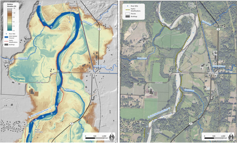
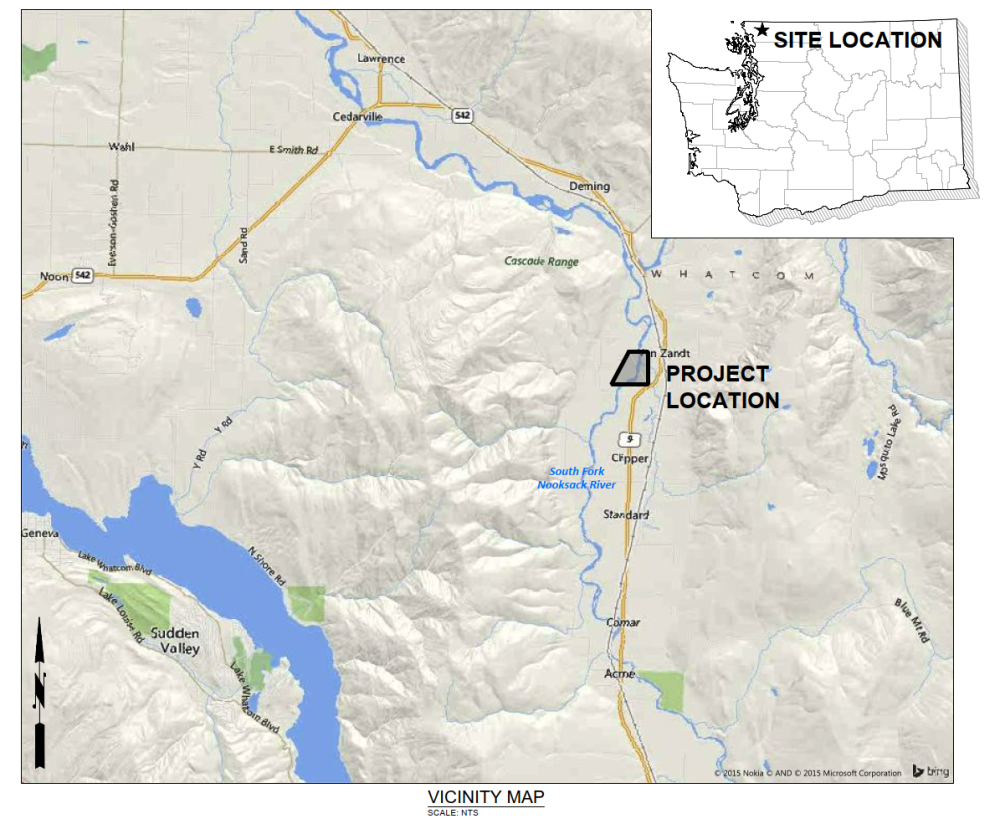
The Upper Van Zandt Restoration Project (formerly the Black Slough Restoration Project) is located on the South Fork (SF) Nooksack River near Van Zandt, river mile (RM) 1.3 and 3, and the Potter Road Bridge. This project is sponsored by the Lummi Nation Natural Resources Department (LNR). Downstream portions of the Black Slough tributary channel (entering the SF at RM 2) may be included in the project design depending on landowner support. The Upper Van Zandt Project aims to improve habitat conditions for threatened SF Nooksack early Chinook (chinook) salmon and reduce flood risk throughout the area.
LNR is building a partnership with Burlington Northern Santa Fe Railroad Company (BNSF) and other adjacent landowners. The project team met individually with landowners in November to discuss specific project concepts. Another field visit is being scheduled in February with interested landowners.
LNR and NSD has shared the latest design iteration during recent site visits with adjacent landowners. This version has been vetted by most stakeholders. The preferred alternative is likely similar to this version. However, more modeling is required to ensure that it can be approved by FEMA for no-rise on insurable structures.
The project team is reviewing the feedback from stakeholders at the January meeting 29th meeting. A preferred alternative and associated hydraulic modeling will be shared soon.
 Project Area Site Maps
 Vicinity Map
The Upper Van Zandt Restoration Project, led by LNR and supported by its engineering team, Natural Systems Design + Coastal Geologic Services (NSD), and outreach consultant, Triangle (project team), is one of several similar projects currently underway in the area that you may already be aware of. The project is being planned in close coordination with these other efforts, which include:
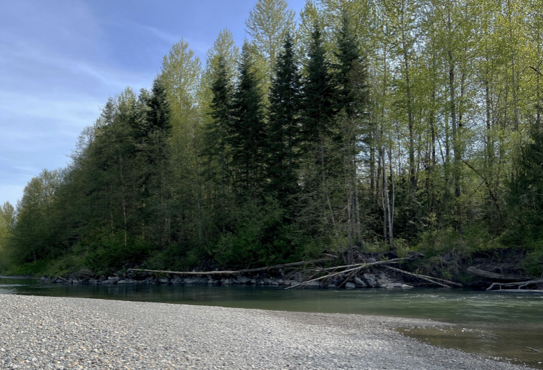
 Close-up of channel and bank conditions
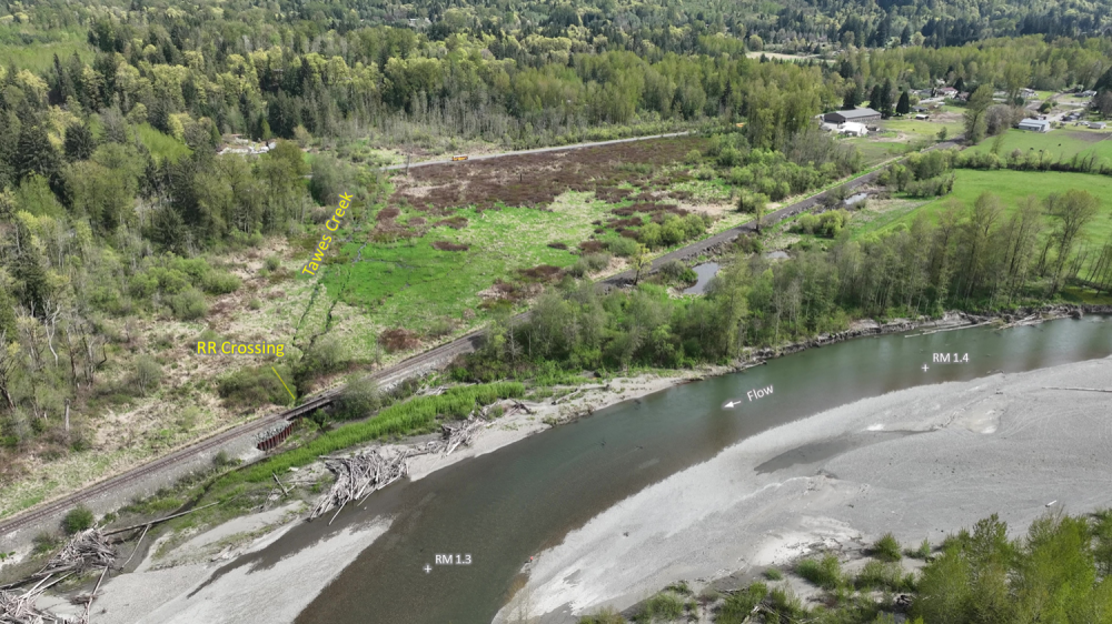
 This is an opportunity to work with BNSF to build a railroad trestle.
The project team is currently assessing geomorphic and hydraulic conditions in the river channel and adjacent banks and floodplains. Team members conducted site visits in April for data collection necessary to complete these assessments. You may have received a phone call, email, or letter asking for permission to access the river via your property. There will be more site visits as the project progresses, and we will always reach out first. LNR, NSD, and the Nooksack Tribe (for the Hardscrabble Project) held a mid-July design kickoff meeting to discuss existing conditions and strategize ideas for proposed conditions. The tribes are working together, keeping the two projects timelines together. .
The engineering team will build upon existing understanding of geomorphic and hydrologic processes in the SFNR developed from recent project experience supporting the Nooksack Tribe with the Hardscrabble-Todd Reach and Homesteader Reach Restoration designs immediately upstream for the Upper Van Zandt project reach. The design team will collaborate with LNR to refine project objectives and identify project constraints.
A suite of conceptual design alternatives will be developed to include design elements such as removal of riprap bank hardening, riparian planting, targeted excavation to increase access to or establish new off-channel habitat, placement of ELJs, side channel creation, and suggestions for targeted land acquisition. At the conceptual design phase NSD will work to identify and advance the restoration potential of the reach, irrespective of FEMA floodplain and other permitting constraints. The alternatives will be presented to stakeholders during community workshops. Geomorphic, hydraulic, habitat, and climate change analyses will be completed to inform design development. The selected alternative will then be adapted to work within FEMA floodplain and other constraints to develop Preliminary and Final (90%) Design levels. Final (90%) Design plans, Basis of Design Report, materials schedules, and cost estimates will then be prepared. A Final Planset will then be prepared for construction.
Opportunities to weigh in on various aspects of the project, including but not limited to:
Please feel free to contact either of the project co-leads with questions.
Alex Levell
Lummi Nation Natural Resources Department
Phone: 360-410-1988 (cell)
Kelley Turner
Lummi Nation
Natural Resources Department
Phone: (360) 306-7244 (cell)
Email: KelleyT@lummi-nsn.gov
Melanie del Rosario
Triangle Associates
Email: mdelrosario@triangleassociates.com
Kate Galambos
Triangle Associates
Phone: (360) 583-3408
Email: outreach@triangleassociates.com