Natural Resources
Notice: This website uses javascript. If you are using a script blocking functionality in your browser you will be unable to use many of the tools on this site. Please whitelist lummi-nsn.gov if you wish to avail yourself of the full functionality of this site. For mapping-related functionality, you may also need to whitelist google.com





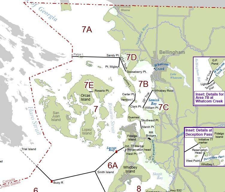 Puget Sound Salmon Management Areas
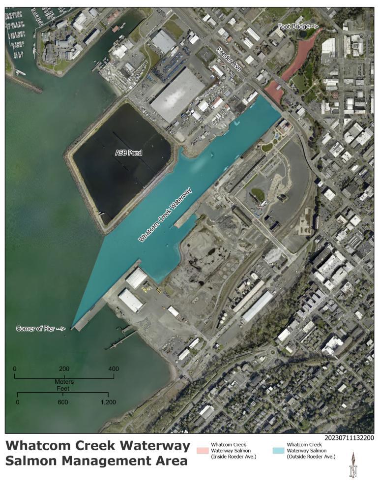 Whatcom Creek Waterway (77H) Detail Map
 Samish Bay (7C) Fishing Area Map
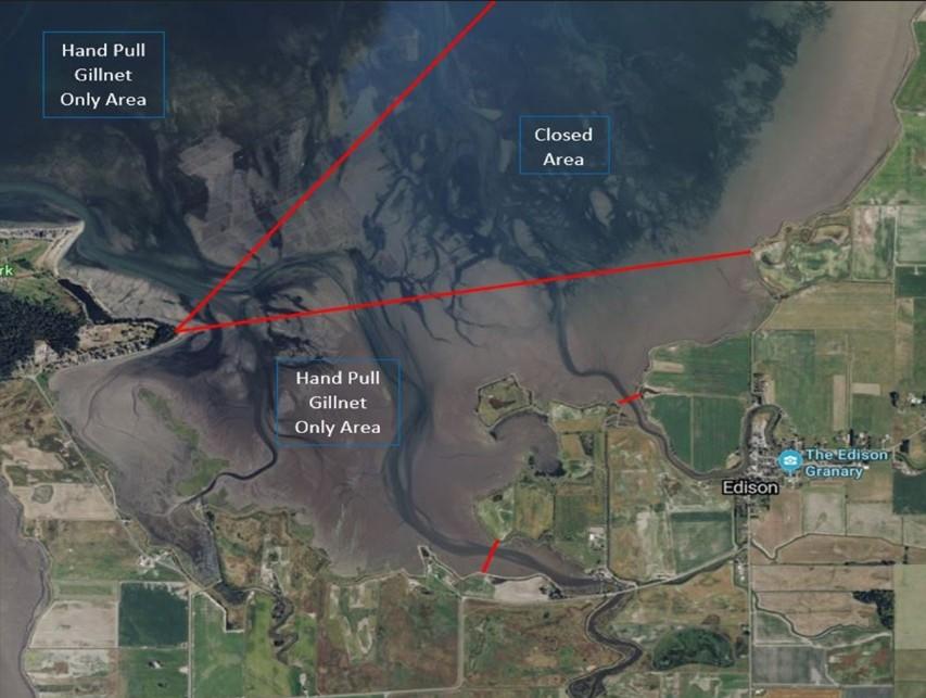 Samish Bay (7C) Fishing Area Detail Map
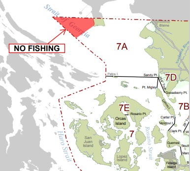 Iverson Dock Line ('Apex') Closure Area Map
 Disclaimer: The official Tide and Tidal Current prediction tables are published annually on October 1, for the following calendar year. Tide and Tidal Current predictions generated prior to the publishing date of the official tables are subject to change. The enclosed data are based upon the latest information available as of the date of your request. Tide and Tidal Current predictions generated may differ from the official predictions if information for the station requested has been updated since the publishing date of the official tables. For more information visit NOAA/COOPS website
There are 2 documents currently available in the Salmon Management Areas portion of the website.